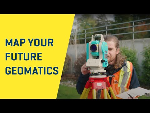
Position Yourself for the Future
The Geomatics Engineering Technology programs are under review and a curriculum change is planned for the September 2024 intake. For more information, please contact geomatics@bcit.ca.
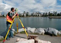
Geomatics is the art and science of measuring, storing, managing and presenting of geospatial data. It has a rich history and an exciting future, where rapidly changing technology is applied directly to the sustainable management of the world’s resources.
Geomatics consists of a wide range of topics, including GPS technology, field surveying, cartography, geodesy, land use planning, photogrammetry, hydrography and cadastral studies.
 Our Programs
The BCIT Geomatics Engineering Technology Program offers a two year Diploma in Geomatics, with the choice of either pursuing a career in the Geomatics industry upon graduation or continuing for a further two years of study toward the Bachelor of Science in Geomatics.
Geomatics attracts students with an interest in mathematics, computers and earth sciences. Employment opportunities are often outdoors, but many students select from a wide variety of other career paths in Geomatics.
In addition to full-time courses, the Geomatics Department also offers part-time studies courses, allowing you to take individual courses at your own pace while you continue to work. A number of the online courses available from BCIT have been granted exemptions by the Canadian Board of Examiners for Professional Surveyors. More information is available on the dedicated CBEPS page.
Spend a few moments looking through the programs we have to offer. If you would like to know more about your options, contact one of our faculty members or visit one of our scheduled Information Sessions.
Geomatics Defined – Can you solve the mystery?
Jonathan Gallant, BCIT Graduate“I entered the Advanced Placement program and in just 1 year I graduated with a two year diploma in Geomatics Engineering. I had a job offer before I finished school and was able to start work immediately after graduating! BCIT gave me the skills and the knowledge to feel confident entering the surveying industry. The teachers are excellent and go to great lengths to teach a daunting amount of material in as efficient and manageable a way as possible for the students.”
Neil Bennett BCLS CLS President Bennett Land Surveying“Bennett Land Surveying has employed many BCIT graduates over the years, we have found them to be well qualified and familiar with the modern technology used throughout the surveying industry. Three of the partners at Bennett are BCIT graduates and a large percentage of the practicing land surveyors in BC are grads of BCIT. The Geomatics programs at BCIT are an excellent stepping stone towards an exciting future career in land surveying.”
Tracey Peet, BCIT Graduate“The BCIT Geomatics Diploma has not only prepared me for working in the field, but has led to continuing opportunities at UNB, earning an engineering degree in Geomatics. Without those two years at BCIT, I would not have the practical or technical skills that employers find so valuable, enabling me to find full-time work doing everything from finding survey evidence from the 1800’s to construction layout for new weigh-in-motion technology.”